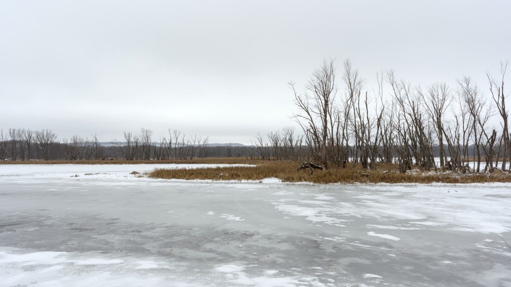
It has been an exceptionally mild winter on the Upper Mississippi River in 2024, with little snow and average temperatures above freezing for much of the past month. It was a different story a year ago. I took these photos between Lansing, Iowa and Winona, Minnesota in 2023.
I. A Backwater Slough
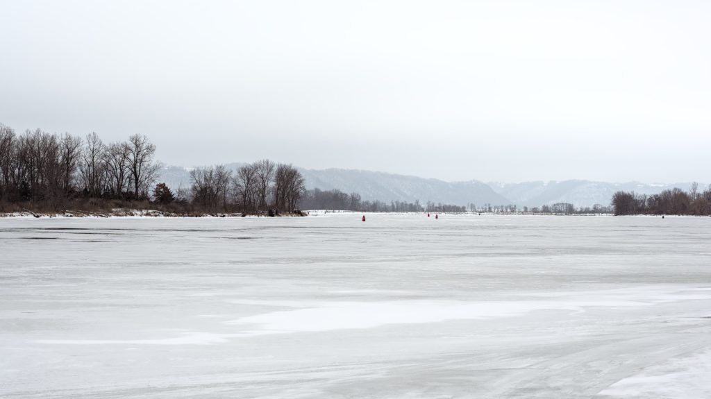
II. The Main Channel
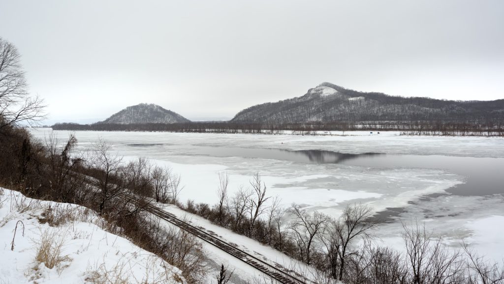
III. La montagne qui trempe à l’eau.
IV. A Reminiscence
In the 19th century, people used sled trains on the river ice during the winter to travel and haul goods. When the ice became too thin for a sled, people traveled by pony until the water thawed completely enough for boats to navigate the river. Antoine Grignon, a fur trader of French, Dakota, and Ho-Chunk ancestry, recounted the following story of a mail delivery that went awry during this period:
One year, in the latter part of winter, early in March, I think, Joseph Reed started from Prairie du Chien with the government mail bound for Winona. When he arrived the carrier from St. Paul was not there. It was mild weather, so Reed concluded to proceed on his journey until he met his partner from up river. By the time he reached Holmes’ Landing, the weather had grown considerably warmer, and the ice showed signs of breaking up. Still he pushed on, and urging his pony over the ice, sped away towards the north. On nearing Minneiska he heard the ice begin to give way — groan, crack, and move; looking about he saw that an island in the river offered his only place of escape from drowning, as the ice was fast breaking up. He made his way thither, and arriving in safety started to explore his new quarters. He had gone but a short distance when he ran across the St. Paul mail-carrier, who had likewise made the island in safety. By this time the ice in the river was moving fast, and before another day had nearly cleared. So there they were with little provision, shut off from mainland by a wide channel.
After their provisions gave out, they subsisted on rose-apples; they halloed in vain for help, but it was a sparsely-settled region at that time and no one heard them. After living on the island nearly two weeks, they were rescued by a party of Sioux who were coming down the river in canoes. The Sioux took the two mail-carriers into their canoes and left them at Holmes’ Landing, where after two weeks of recuperation they resumed their routes. They were weak, emaciated, and nearly starved to death.
Antoine Grignon and Eben Douglass Pierce, “The Recollections of Antoine Grignon,” in Proceedings of the State Historical Society of Wisconsin at Its 61st Annual Meeting Held Oct. 22 and Dec. 19, 1913, (Madison: State Historical Society of Wisconsin, 1914), 116.
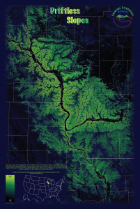
The Driftless Slope Map that I created in 2013 is now available for sale from the nonprofit Crawford Stewardship Project. Both posters and postcards are available. Purchases support environmental sustainability in Crawford County, Wisconsin, at the heart of the Driftless Area.
Crawford Stewardship Project works to protect Crawford County and neighboring regions from threats of polluting and extractive industries, to promote sustainable land use, environmental justice, and local control of natural resources.
Crawford Stewardship Project mission statement
The Crawford Stewardship Project is an independent 501(c)3 nonprofit and I receive no royalties or fees from their merchandise sales.
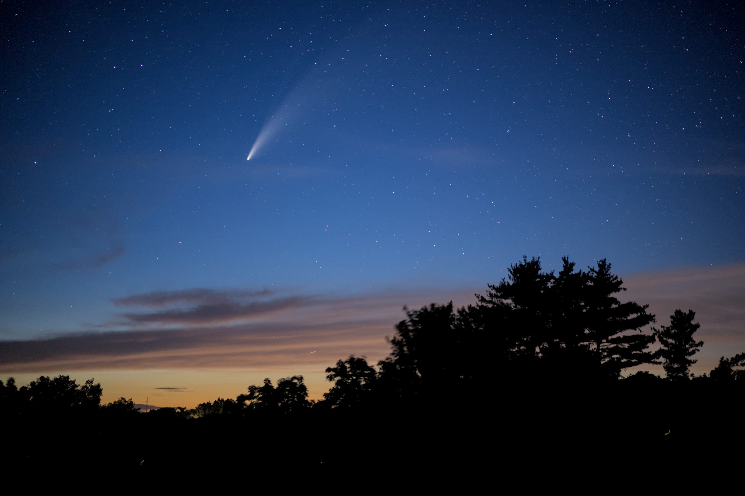
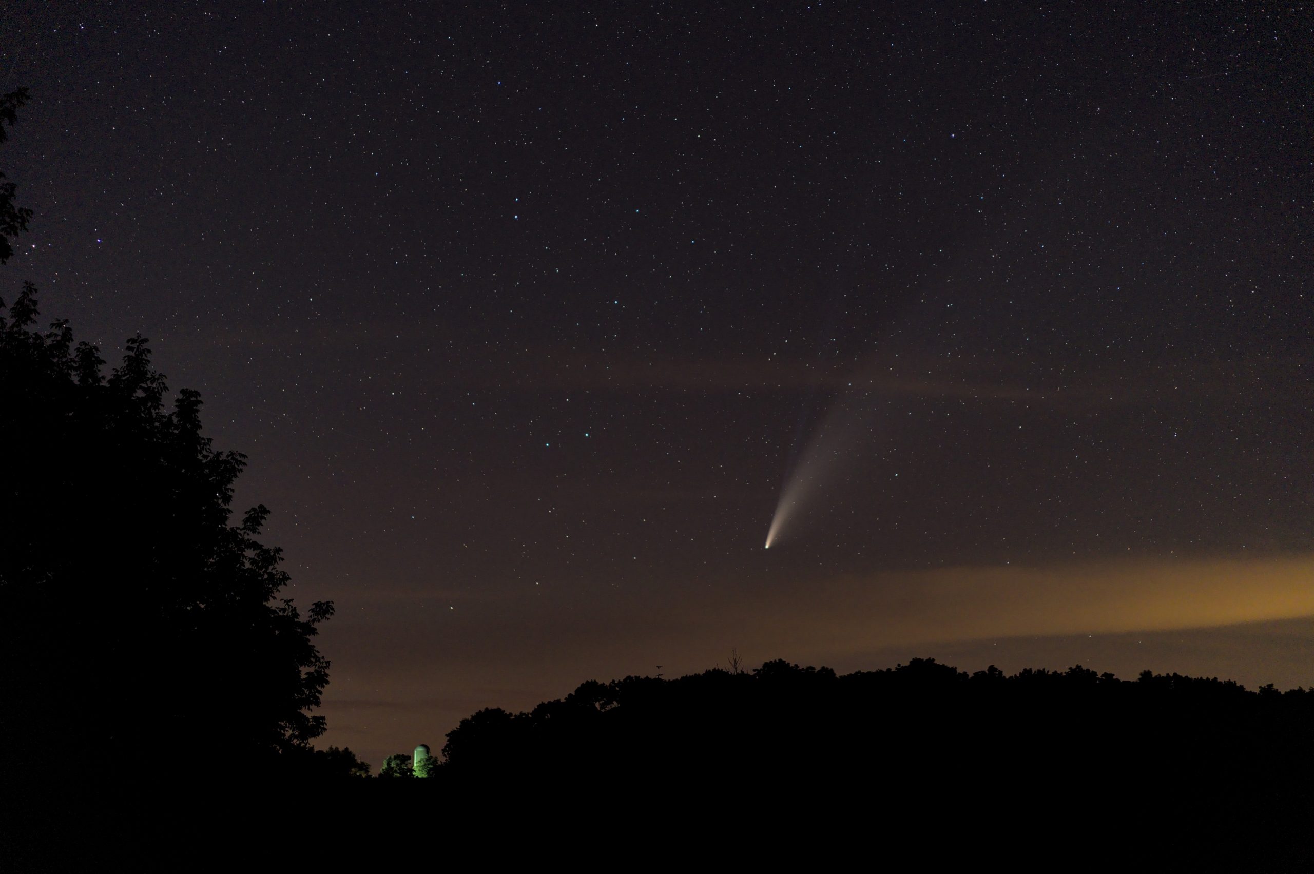
Comet C/2020 F3 NEOWISE, discovered only a few months ago, is now putting on a marvelous show in the northern sky.
I went out last week with a 55mm F1.8 lens to capture some obligatory comet photos and then turned my camera on a few other highlights of the July 2020 evening sky over Wisconsin. Click on a picture to expand it.
I. Comet NEOWISE above the pines:
Comet NEOWISE and a pine grove. About 1½ hours after sunset.
II. Comet NEOWISE and the Farm Silo
Comet NEOWISE nears the horizon, with a farm silo illuminated in the distance. About 2¼ hours after sunset.Continue reading →
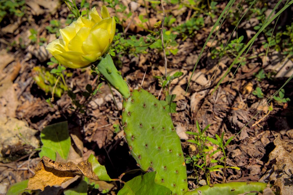
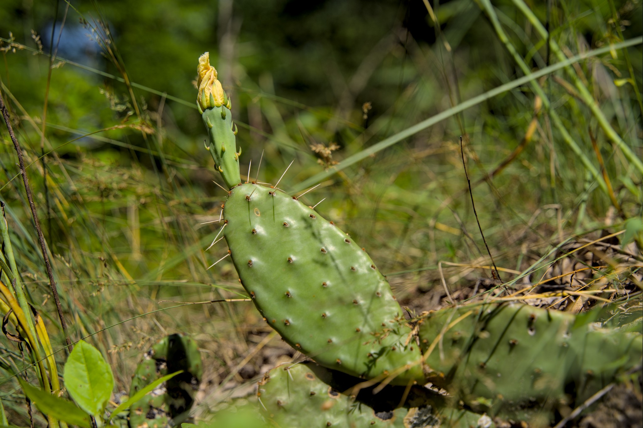
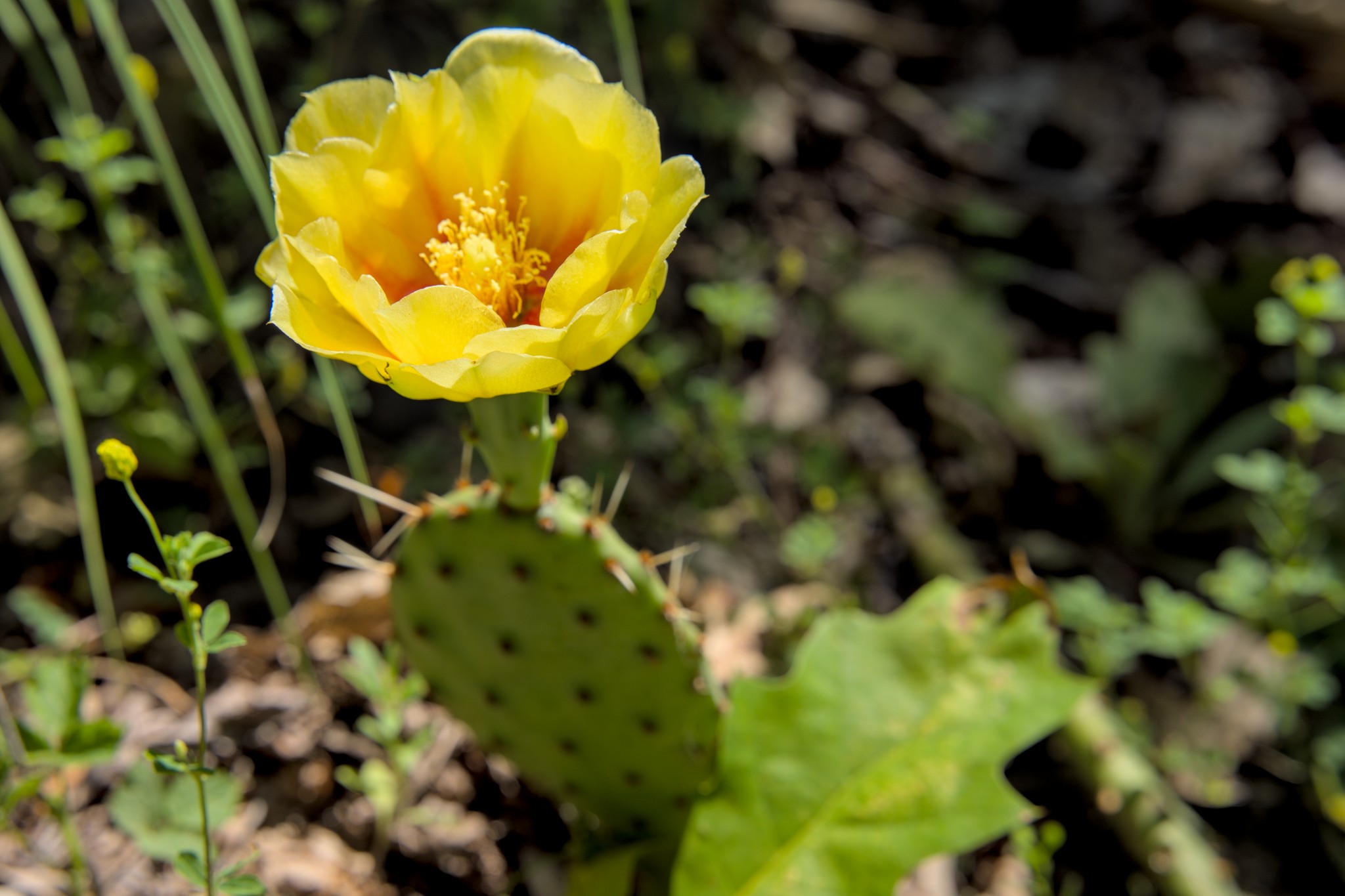
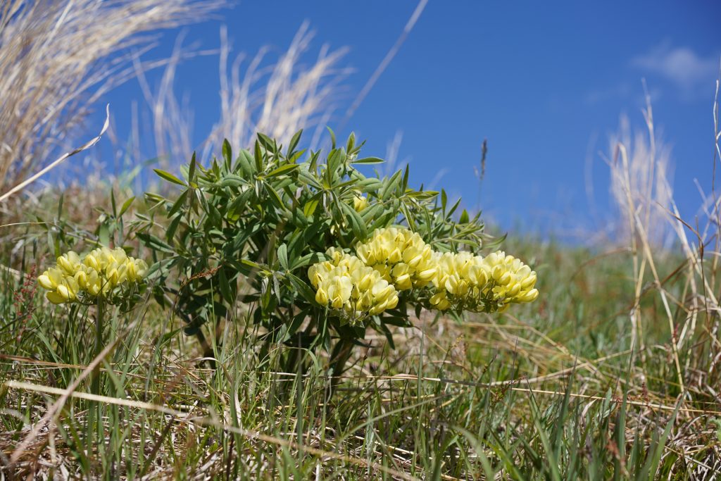
Wisconsin is better known for trees, cows, and snow than for cactus. Even so, multiple species of prickly pears have a native range extending to the Upper Midwest. The cacti are not abundant, but they can flourish in the micro-climates created by well drained, sunny slopes in the Driftless Area.
These wild prickly pear cacti grow along a south facing outcrop of St. Peter sandstone in southwest Wisconsin. I was lucky enough to find them just in time for their short lived yellow blossoms in early July.
While shops, schools, and museums shut down for safety from March to May amid the COVID-19 Pandemic, the woods of Driftless Wisconsin came alive in their usual burst of spring color. This photo gallery looks back at the emergence of spring wildflowers week-by-week.
For another perspective on spring in the Driftless Area, don’t miss the nature walk video series from B&E’s Trees on YouTube: [1][2][3][4][5]. They’re full of interesting information on Wisconsin’s spring ephermals.
April 20
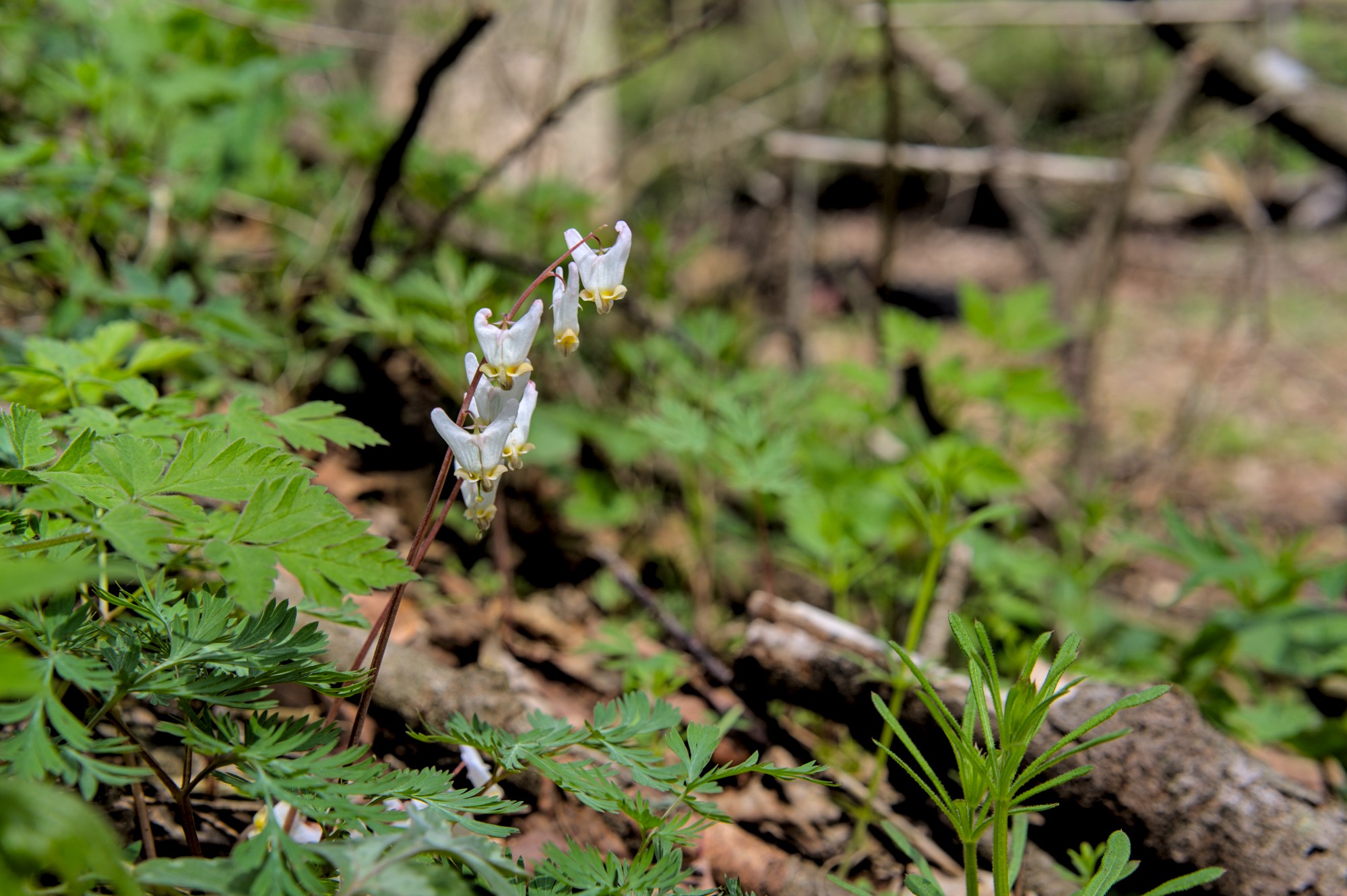
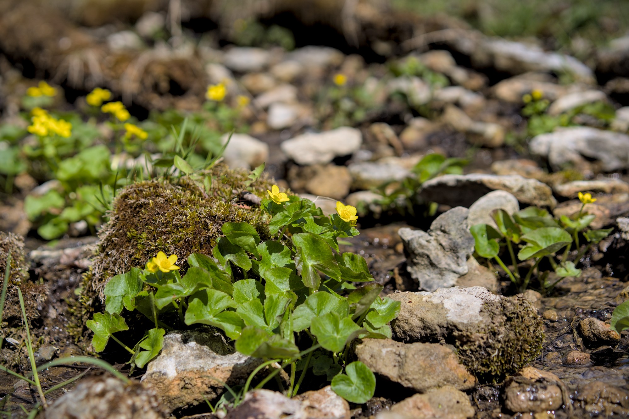
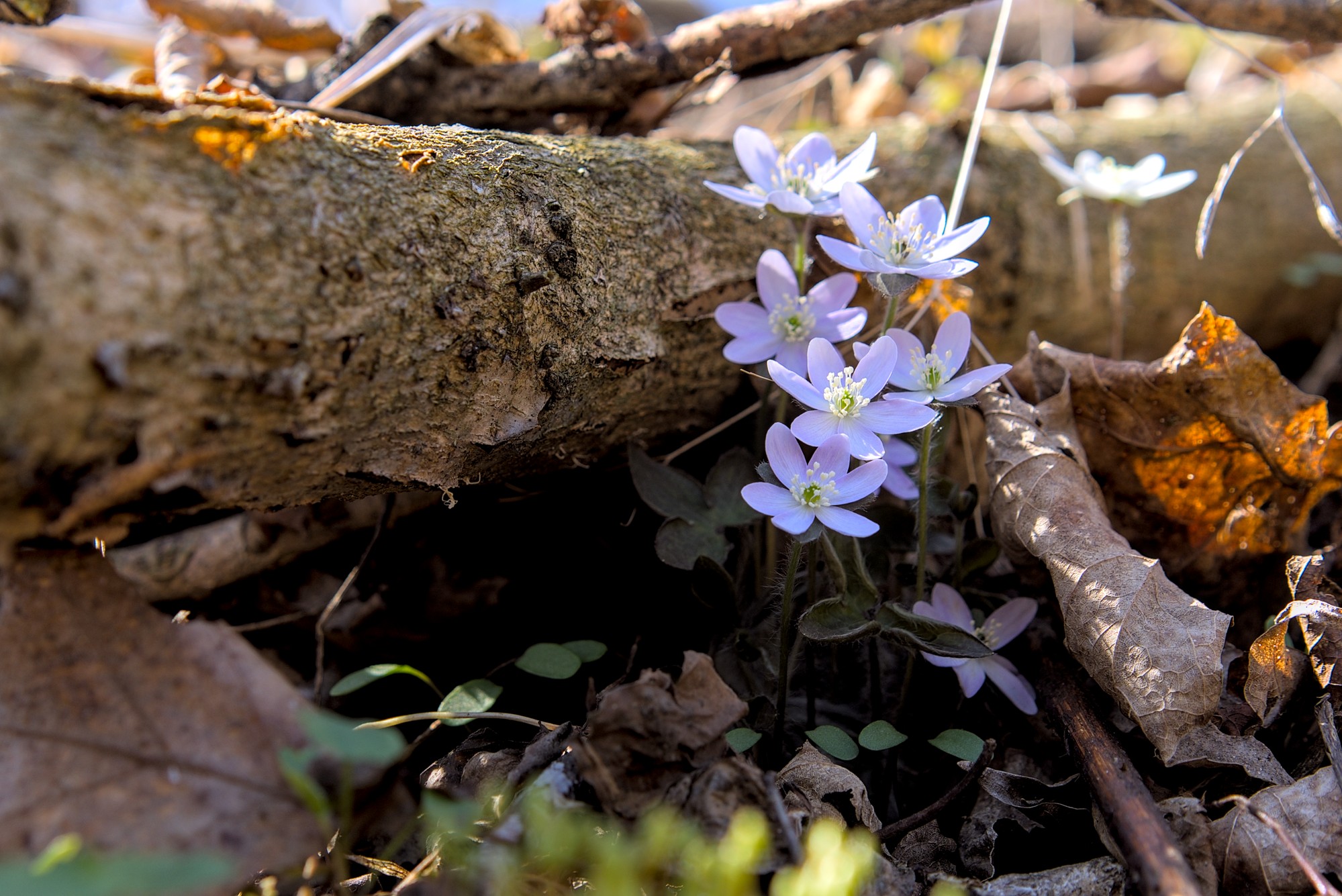
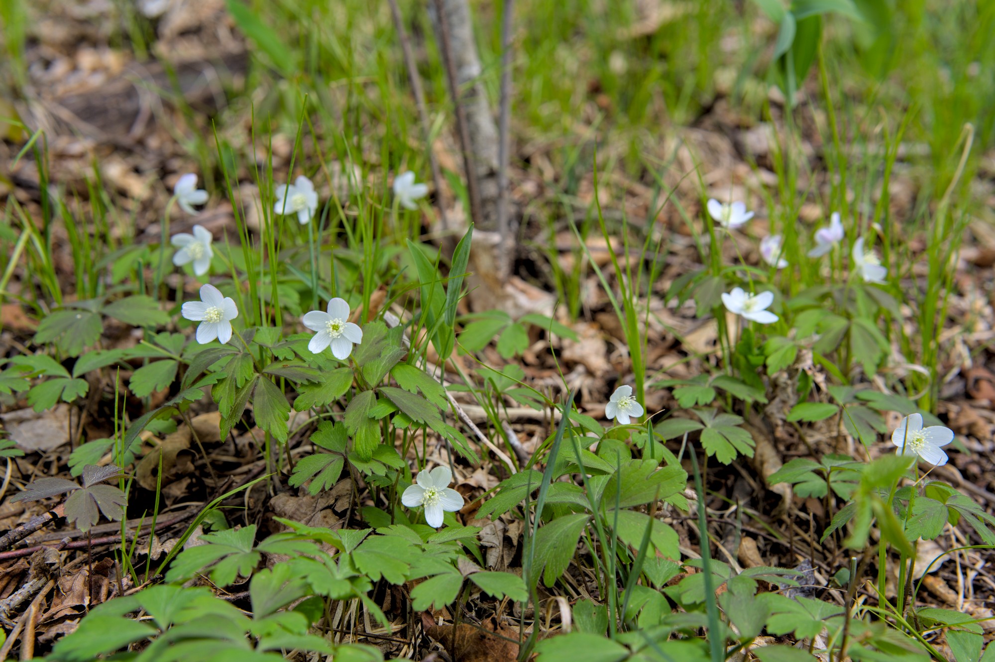
Fragile points of color, the first flowers in April rise only slightly from the bed of last year’s decay. Bloodroot, hepatica, and dutchman’s breeches announce the new season throughout much of the woods. The marsh marigolds cluster only around a well-watered natural spring.
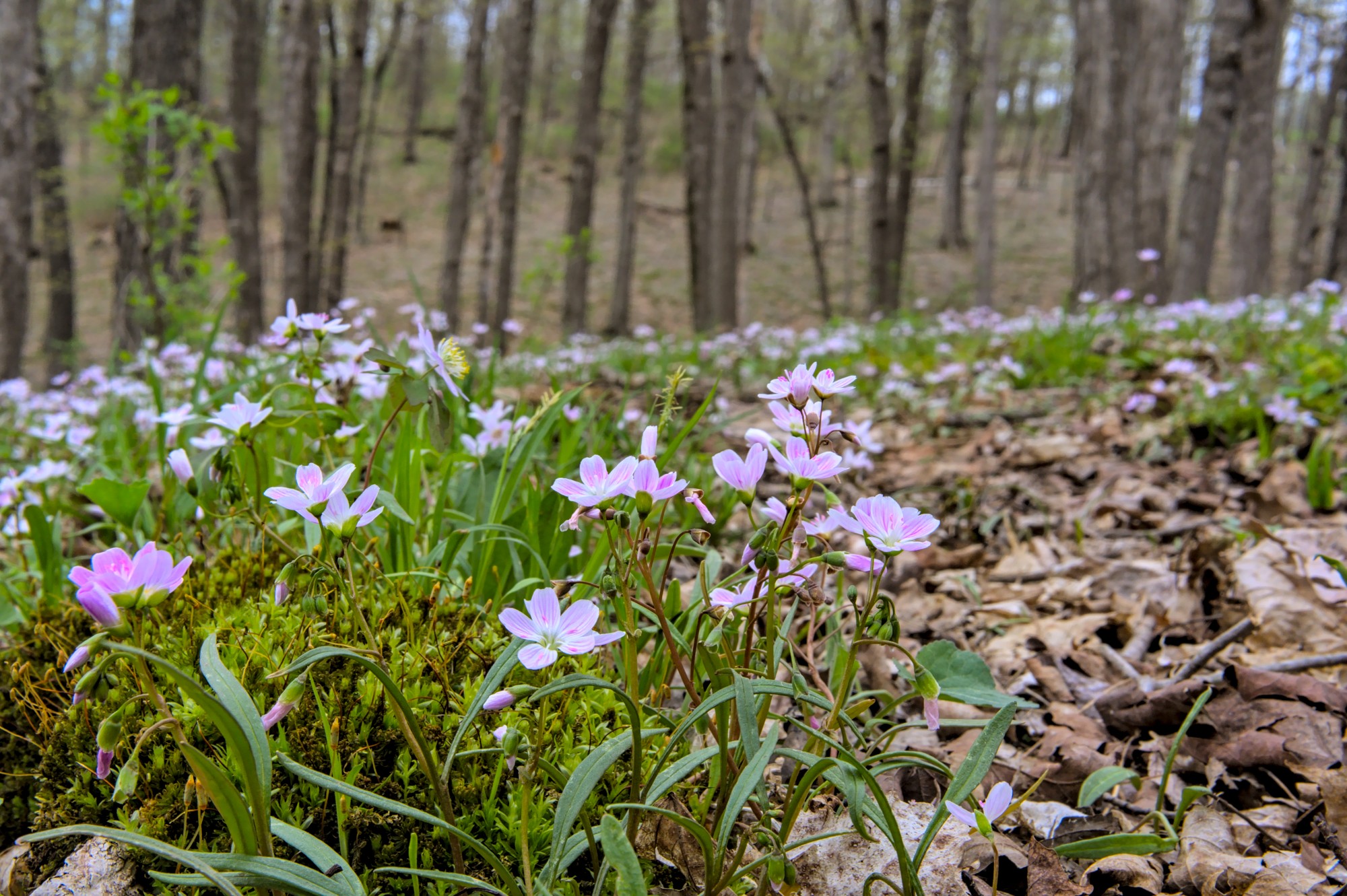
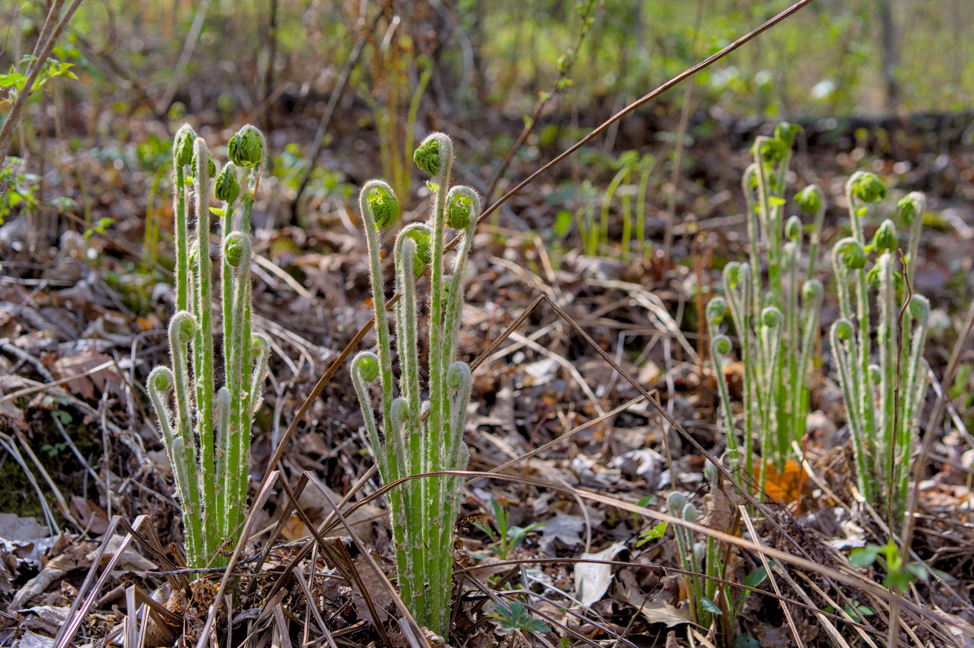
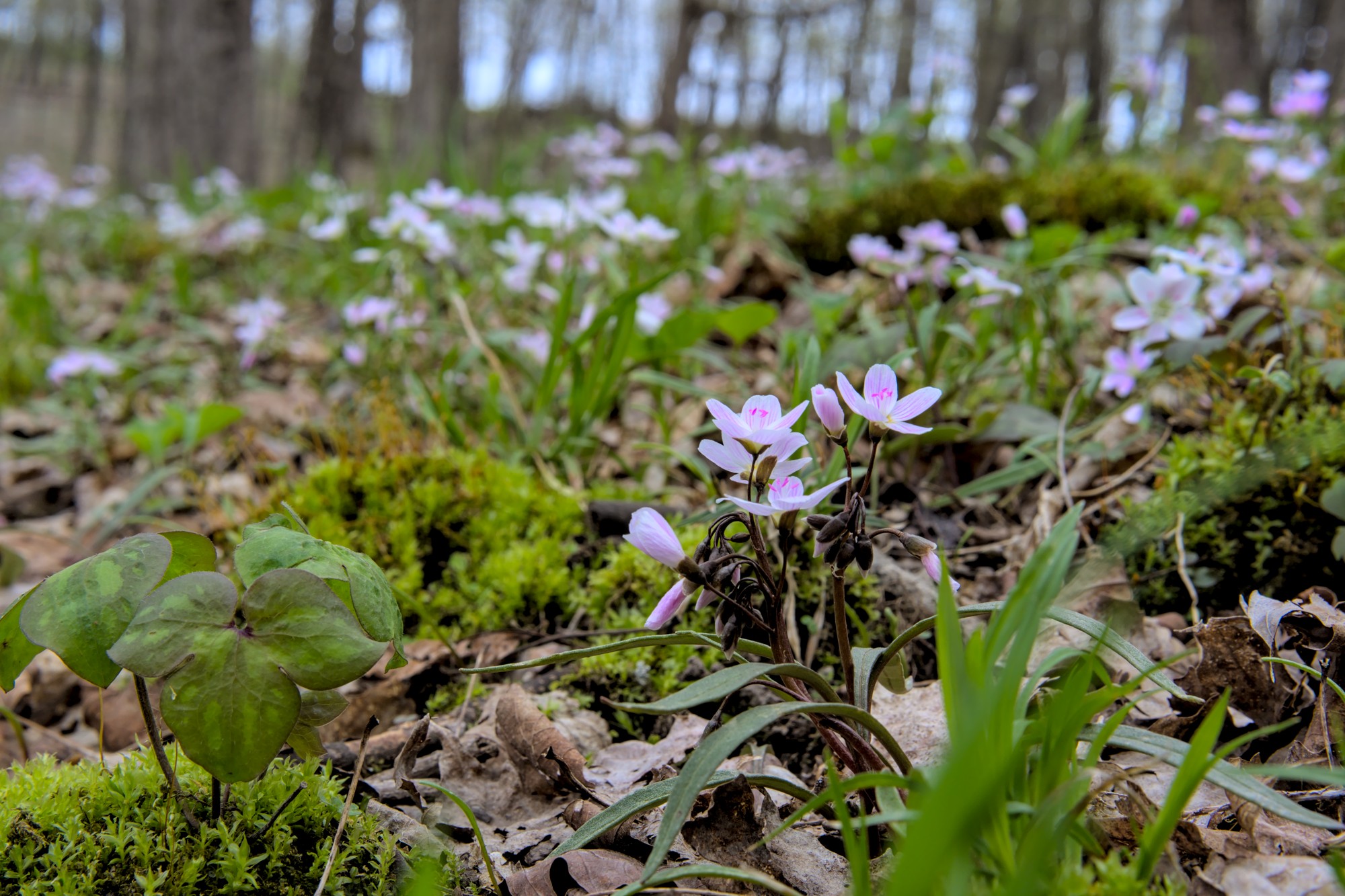
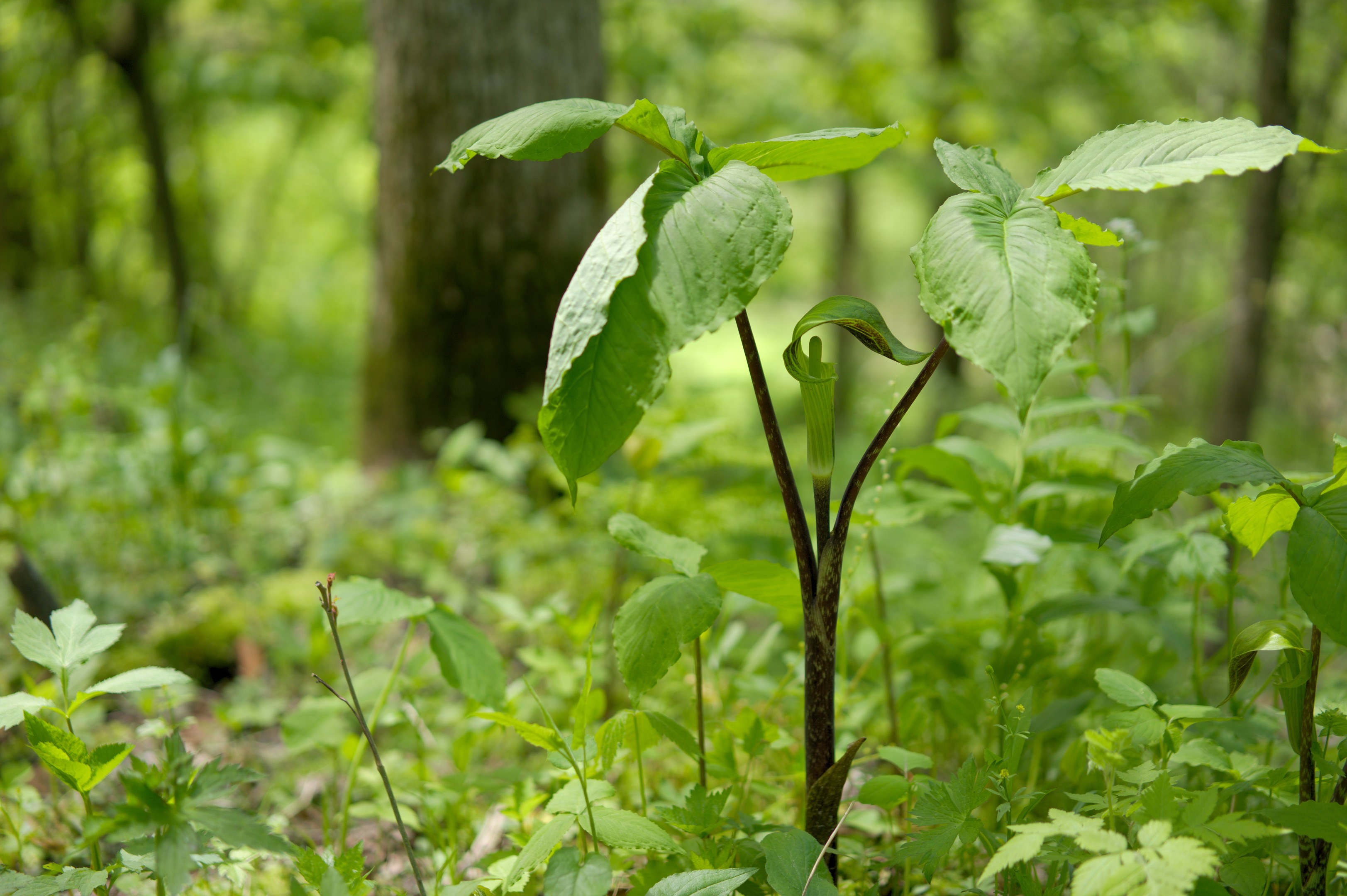
As April turns to May, whole stretches of the woods are carpeted with pink-and-white spring beauty. Tree leaves are beginning to bud, but the canopy is still wide open for sunshine to reach the forest floor. Both rue and wood anemones are widespread, and ferns are uncurling from their fiddleheads.
Spring Beauty and Rue AnemoneWild OatsFernsSpring BeautyWood AnemoneContinue reading →
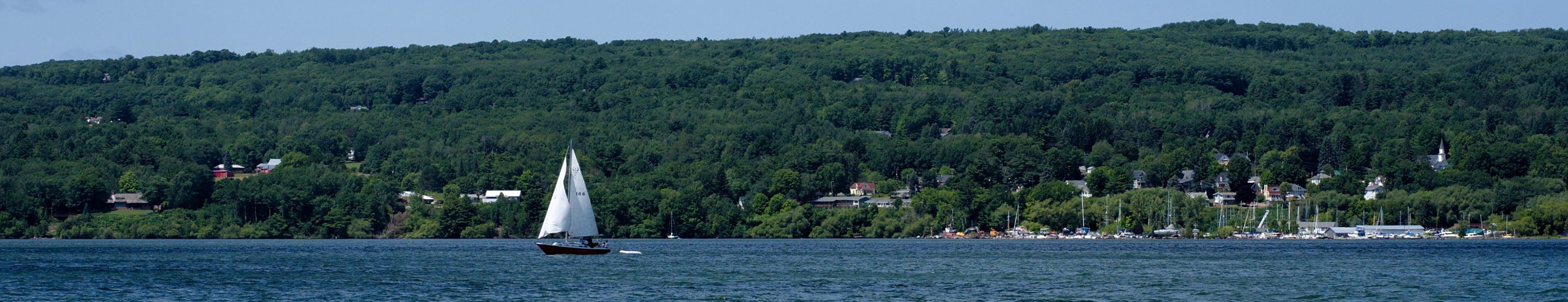
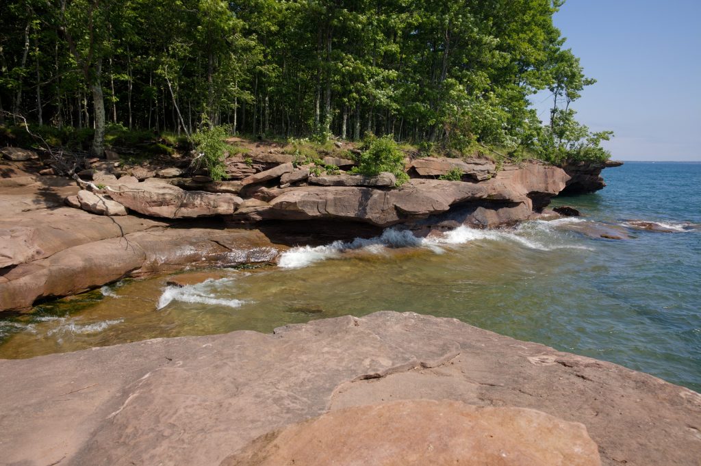
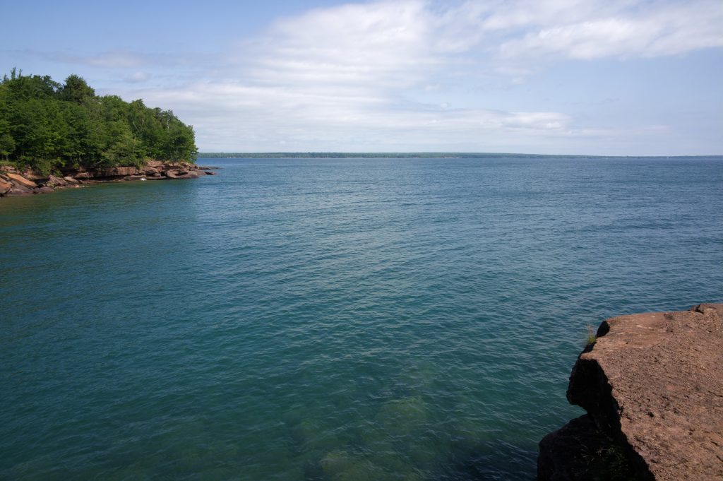
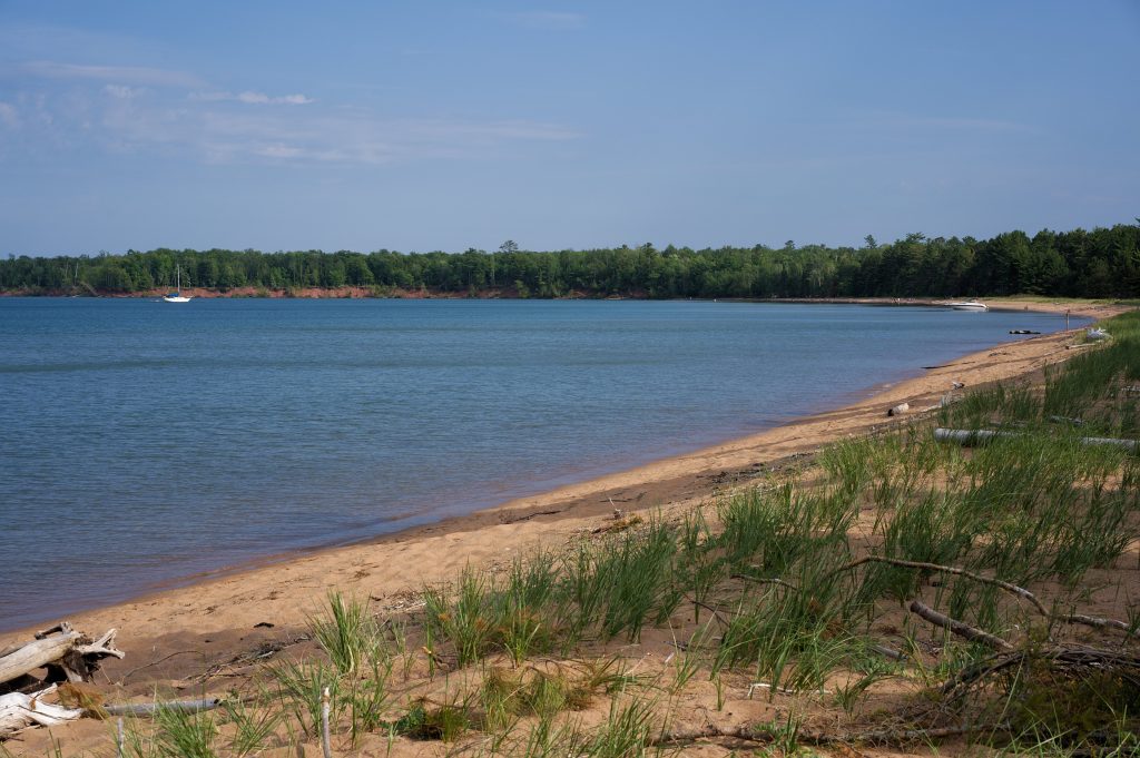
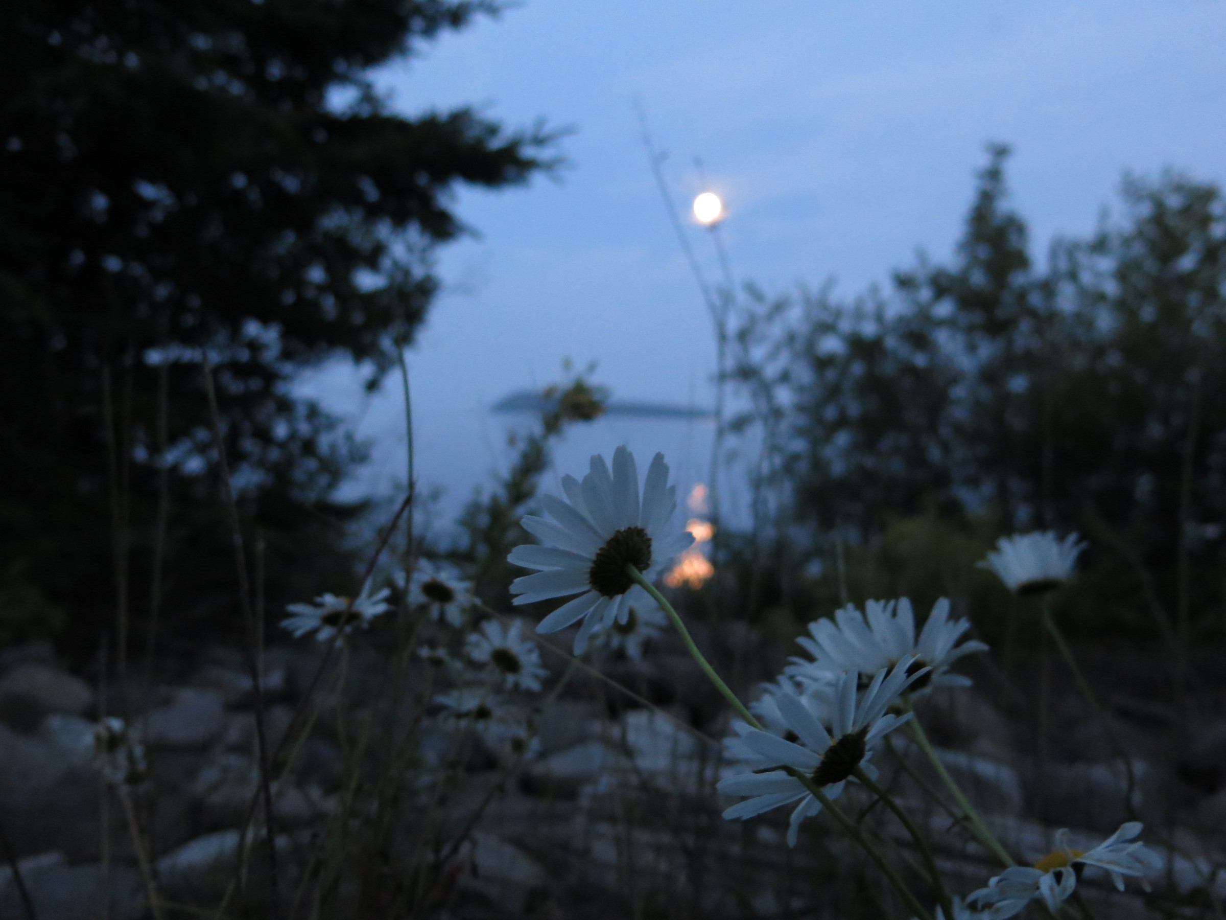
Summers are fleeting but beautiful on Lake Superior. These photos come from a weekend camping trip to Chequamegon Bay and Madeline Island.
The island, known as Moningwunakaauning in the Ojibwe language, was merely a visiting destination for me. For the Anishinaabeg people, it is a sacred place.
Read Winona LaDuke’s essay Restoring a Multi-Cultural Society in a Sacred Place to learn about the island’s history and the challenges of protecting this culturally and environmentally significant corner of the Great Lakes.
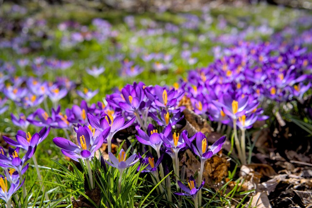
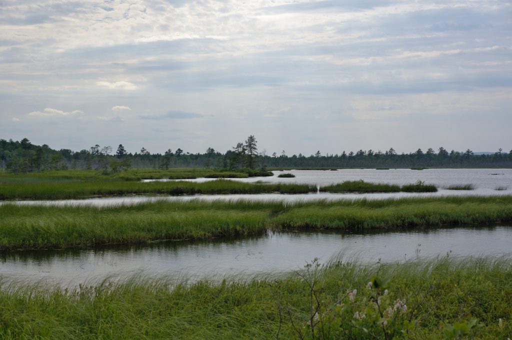
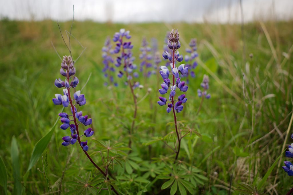
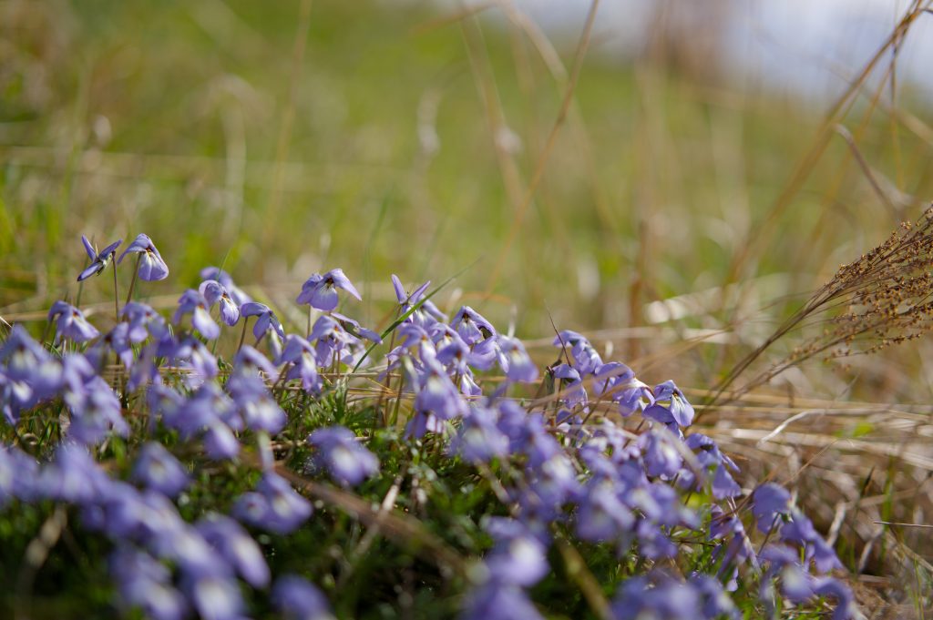
Spring took its time in coming to Wisconsin this year, and when it arrived the rain clouds seemed to hang overhead for weeks at a time. All that water had to make something grow eventually, though, and the prairies were in blossom by the end of May.